How it began
Excavated after the bridge was rebuilt
Crews cut the Channel beneath the bridge and connected both ends to Lake Havasu, placing water around Pittsburg Point.
See the construction order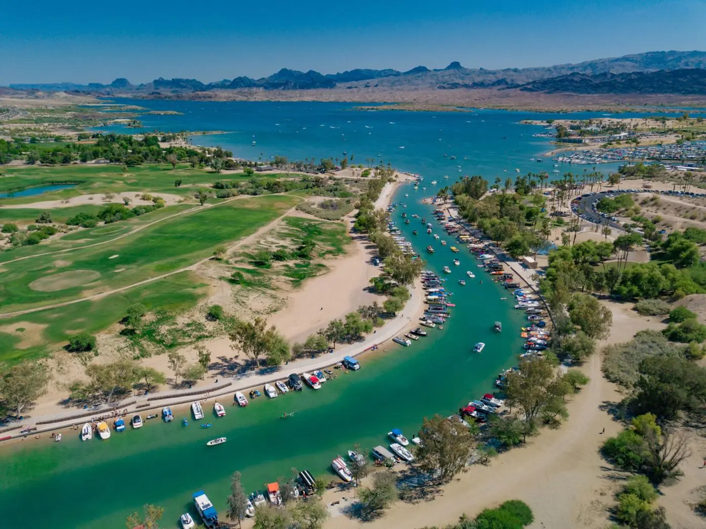
MAINLAND · LONDON BRIDGE · ISLAND · LAKE HAVASU
Bridgewater Channel is the man-made waterway beneath London Bridge that separates the Island from mainland Lake Havasu City. It is where the bridge’s history, pedestrian waterfront, beaches and boat traffic all meet.
Read the Channel like a local map
Bridgewater Channel is a working waterway, a pedestrian setting and the reason Pittsburg Point became the Island. These six choices explain how to use it without confusing a boat route, beach, dock and public walkway.
How it began
Crews cut the Channel beneath the bridge and connected both ends to Lake Havasu, placing water around Pittsburg Point.
See the construction orderWhat it created
The former peninsula became an island; London Bridge remains its primary road connection to mainland Lake Havasu City.
Explore the Island contextWhere to begin on foot
The Visitor Center side gives you signed parking, maps and a straightforward Channel-level approach to the bridge.
Open mainland directionsWhere to add beach time
The city park on the Island side offers designated swimming, ramadas, playgrounds, restrooms, lawns and public parking.
Check park detailsWhat moves through it
The narrow public waterway stays active. Operators, paddlers, swimmers and shoreline visitors must account for one another.
Review boating safetyWhen it changes character
A quiet winter morning and a warm event weekend are completely different visits. Check the date before choosing the route.
Check Lake Havasu City eventsFrom the photo archive
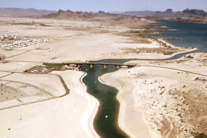
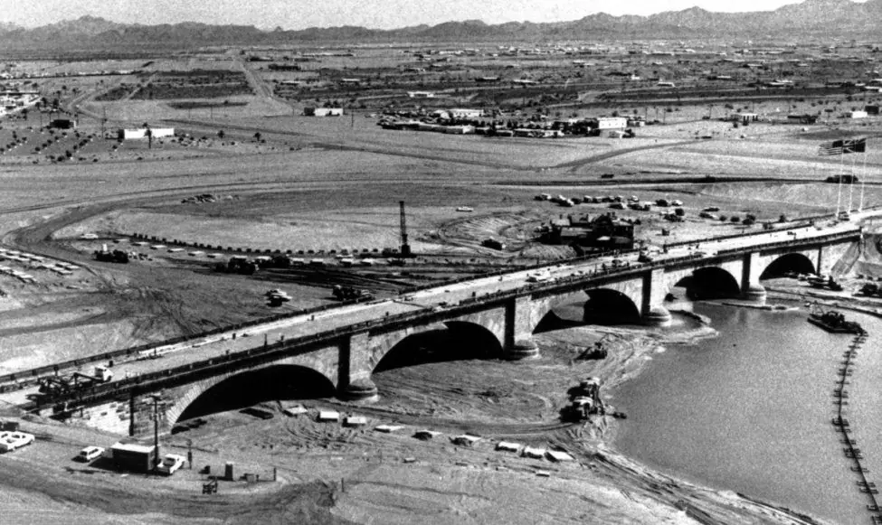
Pittsburg Point was a peninsula when the London Bridge was reconstructed. After the bridge stood on dry land, crews excavated the waterway beneath it and connected the cuts to Lake Havasu. Flooding that channel separated Pittsburg Point from the mainland.
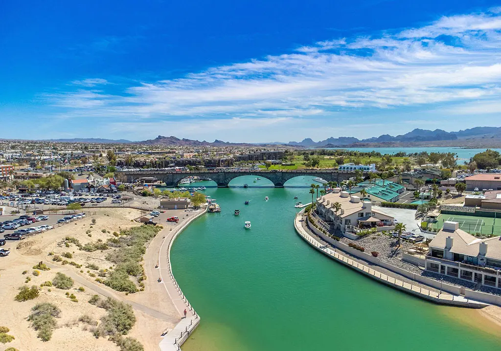
The result is today’s Island, connected by London Bridge at its north end. That history is why the bridge crosses a narrow, active waterway rather than the broad open lake. Read the bridge relocation history for the construction sequence.
The Channel’s two openings allow boat traffic to pass around the Island and beneath the bridge. From above, it reads like a continuous loop; from ground level, it feels like a series of distinct areas—visitor district, working docks, public paths, parks, beaches and resort frontage.
English Village and the Visitor Center sit on the mainland side. The Island side includes parks, beaches, resorts, restaurants, homes and access farther around the Island. The bridge itself carries McCulloch Boulevard between them.
A visitor can explore a meaningful part of the district on foot, but the Channel extends farther than the bridge’s immediate footprint. Decide whether the goal is a bridge walk, a beach stop, dining, paddling or a longer shoreline visit before choosing parking.
For bridge history and first-time orientation, start on the mainland at 422 English Village. For designated swimming and park facilities, use London Bridge Beach on the Island side. For launching a boat, choose a proper ramp before entering the district; waterfront parking is not a substitute for a launch plan.
Boats move through the Channel beneath London Bridge, and the shoreline becomes especially active during warm weekends and major events. Follow posted navigation and speed controls, give docks and swimmers room, and never assume another operator can see a paddler in a crowded section.
Wind and boat wakes can change conditions quickly for kayaks and paddleboards. Check the forecast, use proper flotation equipment and understand where you will launch and exit before entering the water. The Lake Havasu boating guide and boat tour guide provide the next planning layer.
The Go Lake Havasu Channel listing identifies it as a narrow no-wake waterway and says overnight mooring is not allowed. Treat posted signs and current enforcement as controlling. A rental operator can explain equipment and return times, but the operator is not a substitute for knowing the route and conditions yourself.
Use designated beach and swimming areas rather than entering near docks, ramps or concentrated boat traffic. There is no substitute for reading posted rules at the actual location. Water depth, current, wakes and shoreline footing can vary.
London Bridge Beach is a practical Island-side destination for visitors who want shoreline time near the bridge. For a larger park setting, compare Rotary Community Park and Lake Havasu State Park, then verify current fees and facility rules.
The City lists buoyed swimming, twelve ramadas, barbecue areas, two covered playgrounds, restrooms, volleyball, basketball, lawns and a dog park at London Bridge Beach. Glass is prohibited, dogs must be leashed outside the dog park and alcohol requires a permit. Verify current park rules before organizing a group gathering.
The Channel can feel completely different on a quiet winter morning, a summer holiday or a major boat-event weekend. Traffic, beach space, noise and parking are all date-dependent.
Use the Lake Havasu City events calendar before visiting, then open the organizer’s current details. If you prefer a calmer bridge walk, choose an early time and avoid the center of a major Channel event.
During a large event, roads may close, parking may move and the best spectator access may differ from the ordinary visitor route. The calendar is the first step; the organizer’s latest notice is the final authority for admission, launch restrictions, staging and schedule changes.
Open the live location
Plan for the season—and today’s conditions
Lake Havasu offers a different kind of day in every season. Summer is built around early starts, water and shade; winter often brings comfortable afternoons with cooler mornings, evenings and boat rides. Check the live forecast here, then match your bridge walk, Channel stop or lake plan to the temperature and wind you will actually have.

Question → answer → direction
No. It was excavated beneath the reconstructed London Bridge and connected to Lake Havasu, turning Pittsburg Point into the Island.
Yes. Bridgewater Channel is an active boating route. Operators must follow current posted rules and account for congestion, paddlers, swimmers and docks.
There are public paved and shoreline segments around the bridge district, but routes and surfaces are not identical along the entire Channel.
Use a live Lake Havasu events calendar because races, shows, festivals and holiday activity change by date and may affect access.
Check the original source
Historical facts are anchored to official tourism, city and state sources. Use those destinations for schedules, rules and other details that can change after this page is updated.
Keep the plan connected
THE REAL STORY
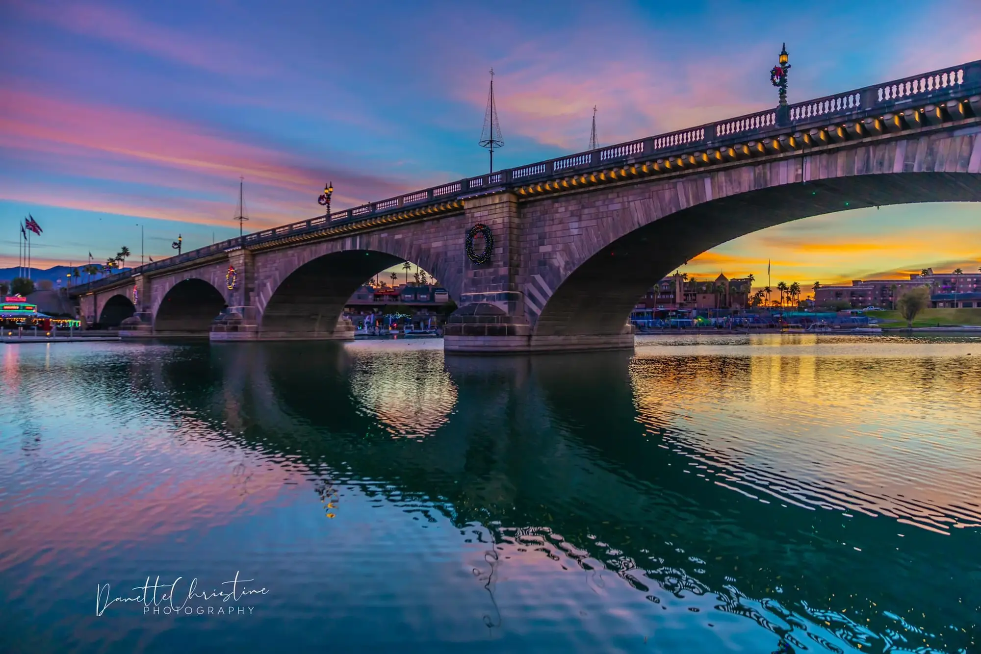
This is the actual London Bridge that crossed the River Thames—not a replica and not Tower Bridge. Robert P. McCulloch bought it from the City of London in 1968, moved its exterior granite to Arizona and rededicated the rebuilt bridge in 1971.
Open the guide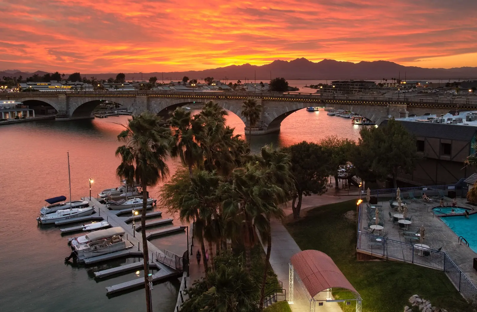
MAINLAND SIDE
English Village is the waterfront visitor and commercial area at the mainland end of London Bridge. It is the most practical place to begin a first visit because the Go Lake Havasu Visitor Center, free parking, maps and Channel access are grouped together.
Open the guide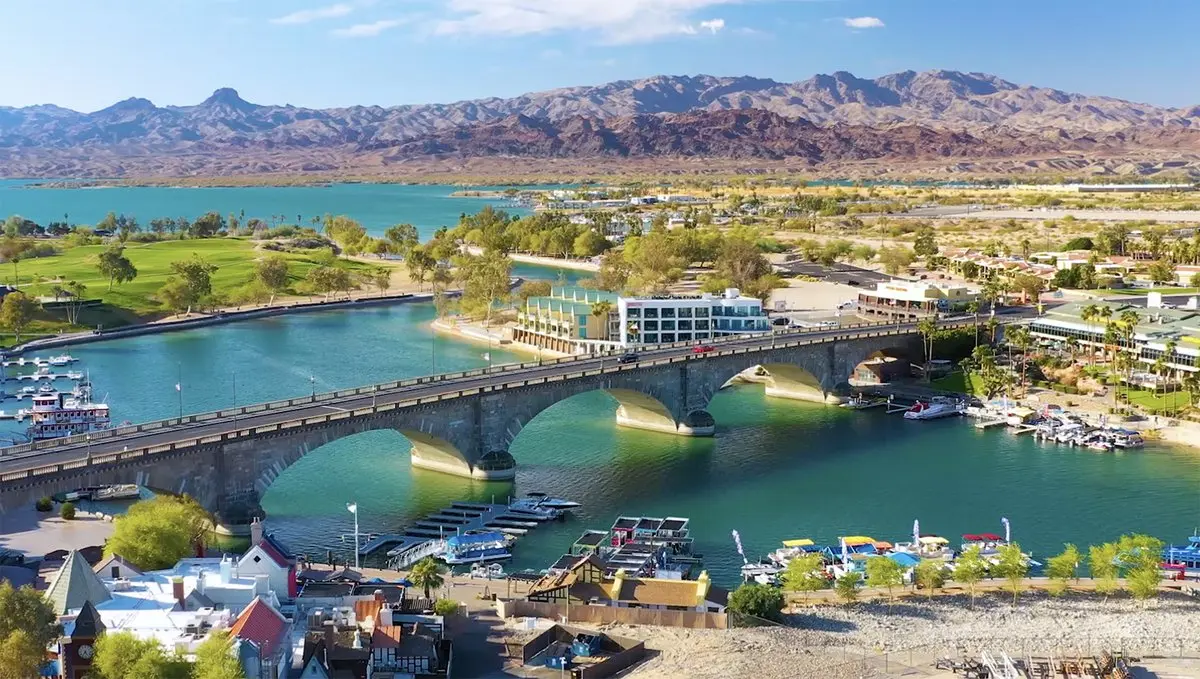
MAP
You do not need a ticket to see or cross the London Bridge. The easiest first stop is the Go Lake Havasu Visitor Center at 422 English Village, where free parking, maps and local information put you beside the mainland end of the bridge.
Open the guide